ACTIVITIES AND HIKES
Activities for everyone!
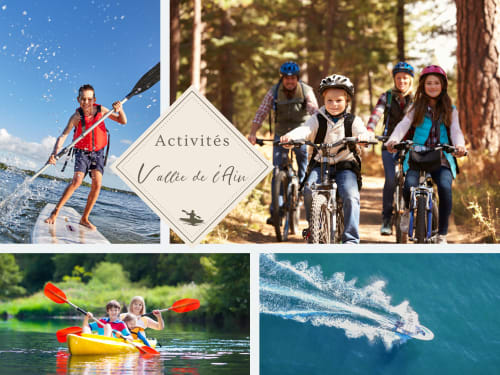
Equipment rental
Our partner Rivershop is located 1km from our estate.
It offers for hire: Stands up Paddle, Canoe, pedalos, 6-seater boat without licence...
You'll also find a range of outdoor and leisure activities, perfect for all ages and experience levels.
Canoeing down the Ain: Enjoy a descent on the Ain river, with routes adapted for family or sporting outings.
Canyoning: Experience an exhilarating adventure in the Ain gorges. Jumps, natural slides, abseils and handrail crossings are all part of the program.
Mountain biking: Explore the picturesque trails of the Ain valley on guided mountain bike tours.
Via Ferrata: Admire the Ain gorges from the heights with this safe, guided activity.
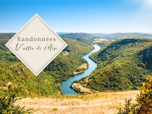
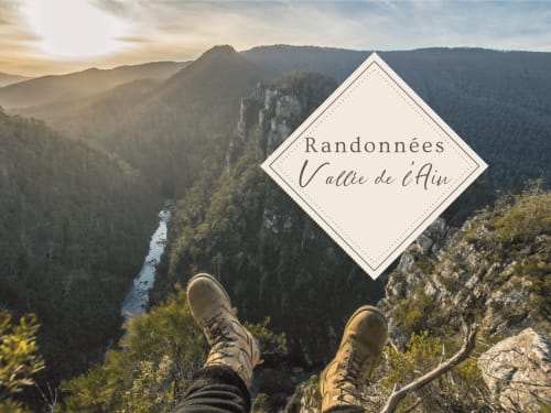
Our most beautiful hikes
Belvédère des Roches
A hiking trail for families, mainly in the forest, allowing you to discover the belvedere des Roches and its breathtaking view over Ile Chambod and the hamlet of Merpuis.
1h41 - 5km - Easy
Carnet de route
Parking: park at the entrance to the hamlet of La Cueille.
1- Go up the hamlet and turn right to pass the Chapelle de La Cueille. Follow the track up to the heart of the forest.
2- At an intersection, turn left towards the belvedere of Les Roches.
3- Once you've enjoyed the view from the belvedere, go back down to the hamlet of La Cueille on the track descending to the left.
4- Once in the hamlet, return to the parking lot.
At Balvay castle
From the ruins of the Château de Balvay, you can enjoy a breathtaking view of the meandering Ain. On a clear day, the view to the west can extend as far as the Monts du Mâconnais, beyond the Revermont and Bresse.
This yellow-marked hike starts from the pretty village of Bolozon. The trail climbs steeply towards Napt through the forest, then reaches the village of Vers on the plateau. It then descends to Solomiat, then Balvay, before returning to Bolozon.
At Balvay, it's advisable to make a return trip to Mont Balvay (15 mins.) to discover the ruins of the castle and the panoramic view over the River Ain.
12 km - 04h30 - Difficult
Carnet de route
- From Saint Etienne church, take rue de la Serra, which climbs towards the fountain in the direction of NAPT.
- On leaving the village, take the Chemin de l'Amont to the right. Follow the path which bends to the left, passes under the SNCF bridge and then crosses the asphalt road which it joins further up.
- 400 m further on, at the crossroads, return to the Notre-Dame de l'Etoile chapel. Turn right to reach NAPT. Drive through the village, past the Saint Martin church.
- After the communal oven, go left, past the wash-house, and take the first path that climbs to the left into the forest. Go around the meadow and take the right-hand path leading to VERS.
- Opposite the fountain, take the path that runs alongside the farm in a pasture, skirting the barbed wire to push a chicane, follow the ridge to the left, and descend along the trees to the bottom left of the meadow. Join the path leading to SOLOMIAT.
- At the oven, fork right and pass the Sainte Marie Magdeleine chapel. Then join BALVAY.
- At Balvay, return to the viewpoint of the castle ruins. Back in the village, turn left down the path to BOLOZON.
Cascade de Pisse Vache
Starting from the village of Bombois, a family walk through the forest leads to this waterfall with a funny name.
After crossing a plateau known as Mailloux, the Bombois stream cascades down the limestone rock face into the heart of the forest.
40min - 3km - Very easy
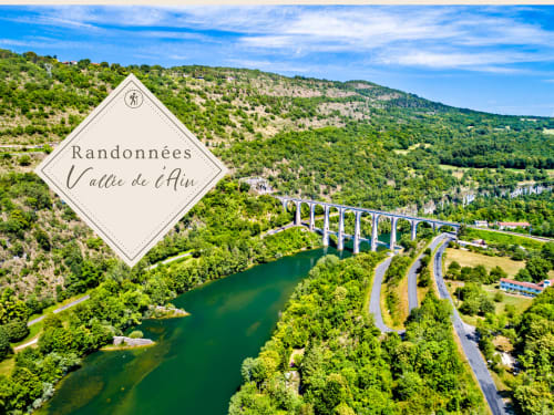
Tour du Val de Buenc - Gorges de l'Ain
A typical Jura valley suspended between the Suran valley and the Ain Gorges. Karstic landscapes, belvederes, forests, cliffs, dinosaur tracks... a great hike in the heights of the Ain.
17 km- 07h00 - Difficult
Carnet de route
Two unique sites in the Revermont:
- Le rocher du Jarbonnet, high cliffs in the Ain gorges
- Dinosaur footprints at Villette
not forgetting the Berranger cliff, the Madone de Grand Corent, views of the Cize-Bolozon viaduct, karstic phenomena...
Possible departures from :
- cize village
- belvedere du Jarbonnet - Bois du Devin
- village of Grand-Corent
- vilette village
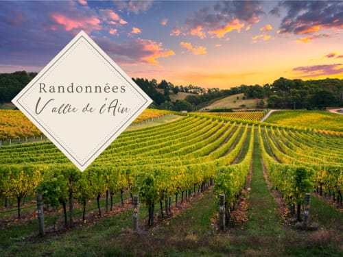
Cerdon vineyard circuit
A hiking trail that takes you through the village of Cerdon, its vineyards and limestone cliffs, with a view of the entire Cerdon valley from the Saint-Alban rock and its ancient church.
7.4 km - 2h15 - Easy
Carnet de route
A- Head for the village square (Mairie), then take rue du Californie (left) as far as a small bridge, which you cross to turn left. Then turn right to Chemin de Moisset, which climbs through vineyards and woods.
B- Before the end of your ascent, follow the track on your right to discover the ruins of the church (11th century) built on a Celtic site dating from the Bronze Age.
C- Return to Bôche via a wide access road.
At the end of this track, turn left to take the Moleyron path (yellow markings).
D/E- At the end of the track, turn left onto the Route du Grignan and go back down to the hamlet of Bôche.
Cross the hamlet (in whole or in part, as the paths merge).
F- After Bôche, a magnificent viewpoint awaits you (450 m).
Enter the vineyards and return to Cerdon, either by the path of your choice, or by the "Sous le pré" access road.
G- At a crossroads (with three other paths), turn right, then left a few metres later.
H- Go back down the track to the village of Cerdon.
When you reach rue des vignes, turn right onto rue des terreaux and return to the parking lot.